National Wetland Inventory
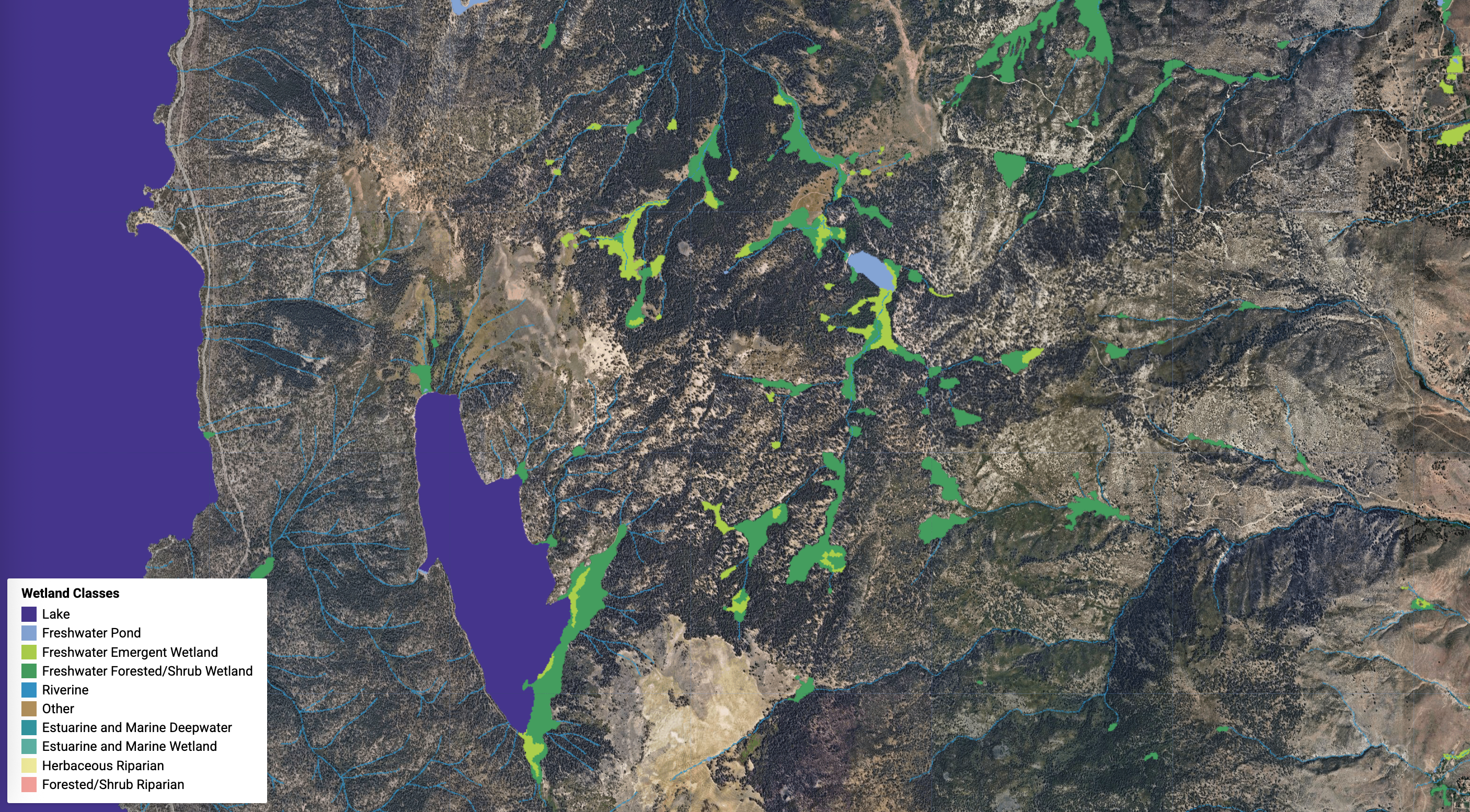
The National Wetlands Inventory (NWI) data in Climate Engine are provided as 3 meter resolution categorical raster image representing the wetland type attribute in the dataset. To produce this dataset, NWI geopackages are downloaded every six months from the https://www.fws.gov/program/national-wetlands-inventory/data-download by state and a lookup table is generated to assign each wetland type class to an integer value. We then use the rasterize function in the rasterio python library to iterate over each state and each Wetland and Riparian NWI layer and produce tiled GeoTIFF images with the integer value corresponding to the wetland type burned into the images. These GeoTIFFs are then converted to cloud-optimized geoTIFFs (COGs), written to Google Cloud Storage, and ingested into Google Earth Engine and, ultimately, Climate Engine.
Description: The US Fish and Wildlife Service (FWS) is the principal US Federal agency tasked with providing information to the public on the status and trends of our Nation's wetlands. Wetlands provide a multitude of ecological, economic and social benefits. They provide habitat for fish, wildlife and plants - many of which have a commercial or recreational value - recharge groundwater, reduce flooding, provide clean drinking water, offer food and fiber, and support cultural and recreational activities. Unfortunately, over half of America’s wetlands have been lost since 1780, and wetland losses continue today. This highlights the urgent need for geospatial information on wetland extent, type, and change. The US FWS National Wetlands Inventory (NWI) is a publicly available resource that provides detailed information on the abundance, characteristics, and distribution of US wetlands. NWI data are used by natural resource managers, within the US FWS and throughout the Nation, to promote the understanding, conservation and restoration of wetlands.
Organization: US Fish and Wildfire Service
Website: https://www.fws.gov/program/national-wetlands-inventory/data-download
Google Earth Engine: https://gee-community-catalog.org/projects/nwi/?h=nation#dataset-and-gee-reference
Terms of Use:
The US FWS National Wetlands Inventory (NWI) is a publicly available resource that provides detailed information on the abundance, characteristics, and distribution of US. NWI datasets are freely available to the public (similar to a CC0 license) and the U.S. Public Domain license.
References:
U.S. Fish & Wildlife Service. (2018). National Wetlands Inventory. U.S. Fish & Wildlife Service. https://data.nal.usda.gov/dataset/al-wetlands-inventory. Accessed 2021-09-19.