National Surface Management Agency Areas
The Surface Management Area (SMA) data in Climate Engine are provided as 10 meter resolution categorical raster images representing the ADMIN_AGENCY_CODE attribute in the dataset. To produce this dataset, the SMA are downloaded from the BLM eGIS portal at https://gbp-blm-egis.hub.arcgis.com/datasets/BLM-EGIS::blm-national-sma-surface-management-agency-area-polygons/about and a lookup table is generated to assign each agency code to an integer value. We then use the rasterize function in the rasterio python library to produce tiled GeoTIFF images with the integer value corresponding to the agency code burned into the images. These GeoTIFFs are then converted to cloud-optimized geoTIFFs (COGs), written to Google Cloud Storage, and ingested into Google Earth Engine and, ultimately, Climate Engine.
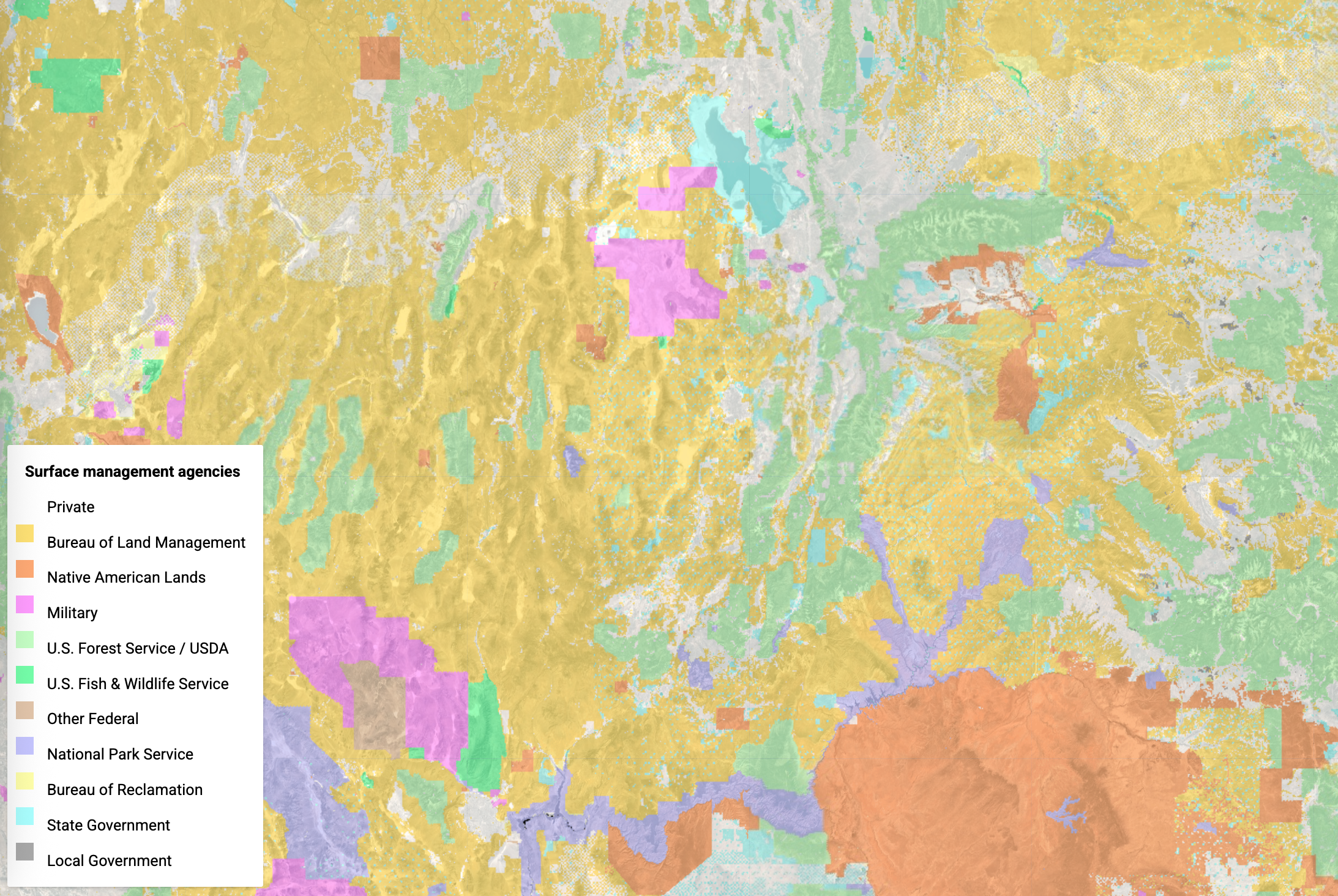
Description: The Surface Management Agency (SMA) Geographic Information System (GIS) dataset depicts Federal land for the United States and classifies this land by its active Federal surface managing agency. The SMA feature class covers the continental United States, Alaska, Hawaii, Puerto Rico, Guam, American Samoa and the Virgin Islands. A Federal SMA agency refers to a Federal agency with administrative jurisdiction over the surface of Federal lands. Jurisdiction over the land is defined when the land is either: Withdrawn by some administrative or legislative action, or Acquired or Exchanged by a Federal Agency. This layer is a dynamic assembly of spatial data layers maintained at various federal and local government offices. The GIS data contained in this dataset represents the polygon features that show the boundaries for Surface Management Agency and the surface extent of each Federal agency’s surface administrative jurisdiction. SMA data depicts current withdrawn areas for a particular agency and (when appropriate) includes land that was acquired or exchanged and is located outside of a withdrawal area for that agency. The SMA data do not illustrate land status ownership pattern boundaries or contain land ownership attribute details.
Organization: Bureau of Land Management
Website: https://gbp-blm-egis.hub.arcgis.com/datasets/6bf2e737c59d4111be92420ee5ab0b46/about
Terms of Use: These data are provided by Bureau of Land Management (BLM) "as is" and might contain errors or omissions. The User assumes the entire risk associated with its use of these data and bears all responsibility in determining whether these data are fit for the User’s intended use. The information contained in these data is dynamic and may change over time. The data are not better than the sources from which they were derived, and both scale and accuracy may vary across the data set. These data might not have the accuracy, resolution, completeness, timeliness, or other characteristics appropriate for applications that potential users of the data may contemplate. The User is encouraged to carefully consider the content of the metadata file associated with these data. These data are neither legal documents nor land surveys, and must not be used as such. Official records may be referenced at most BLM offices. Please report any errors in the data to the BLM office from which it was obtained. The BLM should be cited as the data source in any products derived from these data. Any Users wishing to modify the data should describe the types of modifications they have performed. The User should not misrepresent the data, nor imply that changes made were approved or endorsed by BLM. This data may be updated by the BLM without notification. The SMA data contained in this dataset are extracted from Federal land status records. The official Federal land status records of the appropriate surface land managing agency should be consulted concerning ownership details including interest in the federal subsurface mineral estate. The geographic acreages contained in this dataset are not derived from legal documents associated with title documents or survey records. Rather, they are computed by mathematical programs.